6 September 2017 – 8 September 2017: Las Vegas

Back to LAX. Swap a small car with a medium SUV.
Then we drove to Las Vegas, a city that’s arguably more beautiful at night than during the day.
Revisiting the city, I have found out that that many free shows at various hotels, such as the Pirate Battle at Treasure Island, the Volcano at Mirage & Bellagio fountains were still on.
8 September 2017 – 10 September 2017: Grand Canyon National Park
We departed Nevada on the 8th Morning and headed towards the Grand Canyon.
US roads are great for road trips – relatively flat and straight. Few cops hiding in the bushes like a lone lion trying to ambush a herd of migrating antelopes. Not many tolls to extract that extra few dollars from your wallet.
Grand Canyon is in Arizona, close to the border to Utah. We stayed in a small town called Kanab in Utah, which is at the border of Utah and Arizona. Although the longitude of Arizona and Utah are roughly the same, but because Utah has day light savings and Arizona does not, there is an hour time differences between the two.
The road went from Utah and Arizona back to Utah a few times, telling the exact time became hard if you were not watching where you crossed the border.
Utah and surrounding has some unique landscape and rock formations.
Horseshoe bend is named after its shape. The river beneath is the Colorado river.
There is a dam with a hydraulic power station a short drive away from the Horse shoe bend.
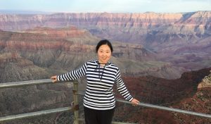
We went to the Grand Canyon North Rim the next day, it was cloudy in the morning, top of the canyon was shrouded in fog. But as the day went on, the fog started to disperse. By middle afternoon, the mist was gone. Grand Canyon took off the veil and revealed its true self to us. Sunset is beautiful in the canyon – sunlight shone from an angle and brought the contrast out of different layers. The scenery was spectacular.

Then the next day we proceeded to the South Rim.
If you are driving, there is no short cut between south rim and north rim. Going from North to South (or vise versa) involves driving around and cross a bridge over the Colorado River. The river isn’t the only thing named after the neighbour state to Arizona, there is also a place called Colorado City along highway 389.
Scenery at side of the road was also amazing, it’s not often when you see a gigantic gap in the middle of a vast flat plain.
South rim gives a more complete picture of the canyon than the North rim. Not only can you see the Colorado river beneath, different layers of the canyon are also very clear.
If you want to gain a bit knowledge on the grand canyon, the Yavapai Geology Museum is a place you should not miss. It’s also a place to understand why it’s called the grand canyon – there are three layers of canyon on top of each other, and the museum is one of the best places to witness this.
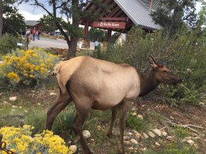
There were plenty of elks in the national park, they were not afraid of people either. On the way back from Grand Canyon south rim, we narrowly missed a deer that jumped right in front of the car.
10 September 2017- 13 September 2017: St George – Bryce Canyon National Park
Utah is an interesting place. I was warned of lacking of proper alcoholic drinks in the supermarket. Yep, no wine or hard liquor sold here, only Low-alcoholic beverages available. There were also some Mormons dressed in traditional clothing.
We visited Bryce Canyon national park. The view was special in its own way. It’s not often one sees a view point hoarded by a bunch of photographers. But at Bruce Point, we witnessed a group people with professional equipment positioning themselves at best viewing spots waiting for sunset.
Various birds came to greet us at breakfast.

13 September – 14 September: Salt lake city
Keep on driving north, we stopped over at the Salt Lake City.

Since the city has been named after it, we became intrigued by this great salt lake. So we went to see the lake for ourselves. Then we found out there was place with plenty of wildlife – Antelope Island.
Going over to Antelope Island State Park involves driving across a bridge over the salt lake.
There were plenty of birds on the lake. According to an official website, the region supports several million birds during busy seasons of the year.
A part of the lake looked like a mirror, reflected sky.
